
1953 Map of Peoria
USGS Topo · Published 1955About this map
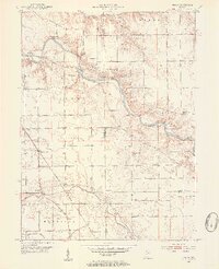
The Mississinewa River carves a winding path through the northern half of this 1953 survey, defining the rugged geography of the Frances Slocum State Forest. Along its banks, the Cliffs of the Seven Double Pillars stand as a prominent landmark near the Frances Slocum Trail. The map captures a transitional landscape where the river’s forested bluffs meet the organized grid of Indiana farmland. Small rural centers like Peoria and Santa Fe anchor the community, while the Chesapeake and Ohio railroad cuts a diagonal line across the southern prairie. Genealogists will find a high density of family and community burial grounds, including Slocum Cem, Keyes Cem, and Fegley Cem, alongside local landmarks like the Pleasant Grove Ch and the Township Sch.
Find a feature on this map
36 named features on this map. Tap any name to fly to it.
Don’t see what you’re looking for? This feature index may not catch every label — zoom into the map to look around manually.
Map Details
Editions of this 1953 Peoria Map
3 editions found
Other maps of this area

1951 · Peru
USGS Topo · 1:24,000

1951 · Bunker Hill
USGS Topo · 1:24,000

1951 · Richvalley
USGS Topo · 1:24,000

1952 · Wabash
USGS Topo · 1:24,000

1953 · Somerset
USGS Topo · 1:24,000

1953 · Danville
USGS Topo · 1:250,000

1953 · Muncie
USGS Topo · 1:250,000

1955 · Danville
USGS Topo · 1:250,000

1956 · Muncie
USGS Topo · 1:250,000

1956 · Danville
USGS Topo · 1:250,000