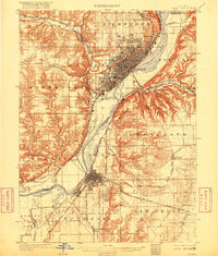
1905 Map of Peoria
USGS Topo · Published 1916About this map
The Illinois River corridor dominates this early twentieth-century landscape, serving as a congested industrial and transportation artery between Peoria and Pekin. The river's influence is evident in the dense concentration of rail lines, including the Peoria and Pekin Union Ry and the Chicago Rock Island and Pacific RR, which hug the banks and connect the riverfront communities. Institutional landmarks of the era are clearly marked, such as the Insane Asylum near Bartonville and the Poor Farm in Limestone township.
Find a feature on this map
59 named features on this map. Tap any name to fly to it.
Don’t see what you’re looking for? This feature index may not catch every label — zoom into the map to look around manually.
Map Details
Editions of this 1905 Peoria Map
4 editions found
Other maps of this area

1893 · Metamora
USGS Topo · 1:62,500

1893 · Dunlap
USGS Topo · 1:62,500

1898 · Dunlap
USGS Topo · 1:62,500

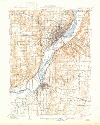
1905 · Peoria
USGS Topo · 1:62,500

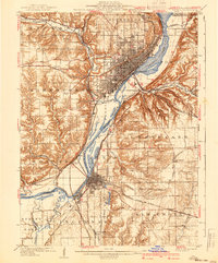
1927 · Peoria
USGS Topo · 1:62,500

1928 · Mackinaw
USGS Topo · 1:62,500

1929 · Manito
USGS Topo · 1:62,500

1930 · Glasford
USGS Topo · 1:62,500

1932 · Mackinaw
USGS Topo · 1:62,500

1932 · Dunlap
USGS Topo · 1:62,500