Loading...
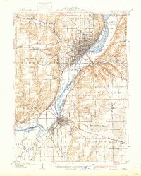
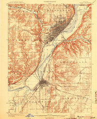
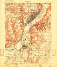
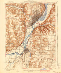
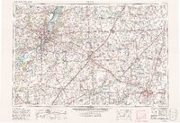
Loading map...1905 Map of Peoria
USGS Topo · Published 1940About this map
Industrial and institutional growth along the Illinois River defines this region during the early twentieth century. As a major rail and river hub, Peoria and its neighbor Pekin are surrounded by a dense network of transit lines, including the Chicago Burlington and Quincy RR and the Galesburg and Peoria Line. The landscape south of the city reveals a concentration of specialized facilities, notably the State Hospital and Insane Asylum in Limestone township, alongside coal extraction sites like Orchard Mines.
Find a feature on this map
62 named features on this map. Tap any name to fly to it.
Don’t see what you’re looking for? This feature index may not catch every label — zoom into the map to look around manually.
Map Details
Date Portrayed1905
Date Published1940
PublisherU.S. Geological Survey
Map TypeTopographic
Scale1:62,500
Physical Dimensions16.78 x 20.89 inches
Editions of this 1905 Peoria Map
4 editions found
Historical Maps of Peoria Through Time
8 maps found


Featured Locations
Source Details
SourceU.S. Geological Survey
CopyrightPublic Domain