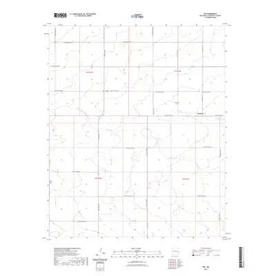
2023 Map of Pep
USGS Topo · Published 2023About this map
The high plains of Roosevelt County are defined by a rigid grid of agricultural roads and small ranching settlements. Pep and Richland serve as the primary landmarks in this expanse, connected by a network of thoroughfares such as Dora Main St and S Roosevelt Road 29. The layout of the land reflects the Public Land Survey System, with township and range lines like t5s r35e and t6s r35e marking the transition across the terrain. For those researching the social history of this rural area, the Richland Cem and New Hope Cem are critical anchor points, providing a link to the families who established these remote communities in the eastern New Mexico grasslands.
Find a feature on this map
23 named features on this map. Tap any name to fly to it.
Don’t see what you’re looking for? This feature index may not catch every label — zoom into the map to look around manually.
Map Details
Editions of this 2023 Pep Map
This is the sole edition of this map. No revisions or reprints were ever made.
Other maps of this area

1954 · Brownfield
USGS Topo · 1:250,000

1958 · Brownfield
USGS Topo · 1:250,000

1962 · Brownfield
USGS Topo · 1:250,000

1972 · Bluit
USGS Topo · 1:24,000

1972 · Dora NW
USGS Topo · 1:24,000

1972 · Garrison
USGS Topo · 1:24,000

1972 · Milnesand
USGS Topo · 1:24,000

1972 · Dora SW
USGS Topo · 1:24,000
1972 · Pep
USGS Topo · 1:24,000
1972 · Causey West
USGS Topo · 1:24,000