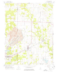
1965 Map of Percy
USGS Topo · Published 1977About this map
Strip mining operations dominate the western landscape of this mid-1960s survey, marking a significant industrial presence between Percy and Cutler. These sprawling excavations contrast with the surrounding agricultural character of Six Mile Prairie and the smaller settlements of Jamestown and Lost Prairie. The region is defined by a dense network of watercourses, including Galum Creek and Bonnie Cr, which drain the southern Illinois terrain.
Find a feature on this map
27 named features on this map. Tap any name to fly to it.
Don’t see what you’re looking for? This feature index may not catch every label — zoom into the map to look around manually.
Map Details
Editions of this 1965 Percy Map
3 editions found
Other maps of this area

1910 · Murphysboro
USGS Topo · 1:62,500

1914 · Coulterville
USGS Topo · 1:62,500

1916 · Campbell Hill
USGS Topo · 1:62,500

1917 · Coulterville
USGS Topo · 1:62,500

1918 · Campbell Hill
USGS Topo · 1:62,500

1924 · Pinckneyville
USGS Topo · 1:62,500

1926 · Pinckneyville
USGS Topo · 1:62,500

1938 · Murphysboro
USGS Topo · 1:62,500

1949 · Paducah
USGS Topo · 1:250,000

1950 · Paducah
USGS Topo · 1:250,000