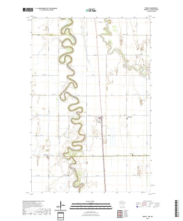
2022 Map of Perley
USGS Topo · Published 2022About this map
The Red River of the North defines the western border of this region, its tightly wound meanders forming a complex natural boundary between North Dakota and Minnesota. This 2022 survey captures the agricultural landscape surrounding Perley, where the terrain is marked by a precise grid of rural roads and drainage patterns leading toward the Wild Rice River in the east. The map is particularly dense with sites of genealogical interest, preserving the locations of several historic burial grounds that reflect the area's early settlement. These include the Old Bethlehem Lutheran Cem, Nora Lutheran Church Cem, Kirkebo Cem, and the North Nora Pioneer Cem. The proximity of these churches and cemeteries to the river suggests the importance of the waterway in orienting early pioneer life and community development in Norman County.
Find a feature on this map
58 named features on this map. Tap any name to fly to it.
Don’t see what you’re looking for? This feature index may not catch every label — zoom into the map to look around manually.
Map Details
Editions of this 2022 Perley Map
This is the sole edition of this map. No revisions or reprints were ever made.
Other maps of this area

1918 · Hendrum
USGS Topo · 1:62,500

1924 · Ada
USGS Topo · 1:62,500

1952 · Grand Forks
USGS Topo · 1:250,000

1956 · Grand Forks
USGS Topo · 1:250,000

1963 · Georgetown
USGS Topo · 1:24,000
1963 · Argusville
USGS Topo · 1:24,000

1963 · Perley
USGS Topo · 1:24,000

1963 · Gardner
USGS Topo · 1:24,000

1963 · Halstad
USGS Topo · 1:24,000

1963 · Halstad SW
USGS Topo · 1:24,000