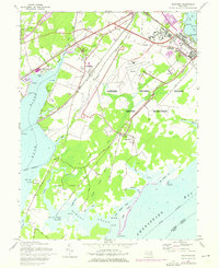
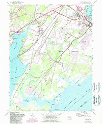
1948 Map of Perryman
USGS Topo · Published 1976About this map
The Aberdeen Proving Ground Military Reservation dominates the eastern half of this landscape, reflecting its expansion during the mid-20th century. This 1948 survey, with purple revisions from 1970, captures a region defined by its strategic coastal position and rail connectivity. The Penn Central and Baltimore and Ohio railroads anchor the settlements of Perryman and Belcamp, where the terrestrial landscape meets the tidal waters of the Bush River and Chesapeake Bay.
Find a feature on this map
68 named features on this map. Tap any name to fly to it.
Don’t see what you’re looking for? This feature index may not catch every label — zoom into the map to look around manually.
Map Details
Editions of this 1948 Perryman Map
5 editions found
Other maps of this area

1893 · Gunpowder
USGS Topo · 1:62,500

1898 · Tolchester
USGS Topo · 1:125,000

1900 · Havre De Grace
USGS Topo · 1:62,500

1900 · Betterton
USGS Topo · 1:62,500

1901 · Belair
USGS Topo · 1:62,500

1901 · Gunpowder
USGS Topo · 1:62,500

1903 · Tolchester
USGS Topo · 1:125,000

1908 · Tolchester
USGS Topo · 1:125,000

1941 · Gunpowder
USGS Topo · 1:62,500

1942 · Havre De Grace
USGS Topo · 1:62,500