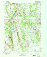
1954 Map of Perrysburg
USGS Topo · Published 1972About this map
The boundary between Chautauqua County and Cattaraugus County defines this mid-century rural landscape, where the Erie RR cuts through the uplands. Settlement patterns here are tied to the drainage of Silver Creek in the north and the North Branch Conewango Creek toward the south. Small, numbered school districts like School No 8 and School No 4 remain central landmarks in agricultural hamlets such as Nashville and Balltown. Significant local institutions include the Memorial Hospital near the town of Perrysburg, while the Silver Creek Reservoir and East Mud Lake provide the primary water features in this dissected plateau. The presence of several community burial grounds, including the Perrysburg Cem and Cottage Cem, offers valuable points of reference for genealogists studying the families of the Hanover and Dayton townships during the early 1950s.
Find a feature on this map
46 named features on this map. Tap any name to fly to it.
Don’t see what you’re looking for? This feature index may not catch every label — zoom into the map to look around manually.
Map Details
Editions of this 1954 Perrysburg Map
4 editions found
Other maps of this area

1899 · Silver Creek
USGS Topo · 1:62,500

1900 · Cherry Creek
USGS Topo · 1:62,500

1905 · Eden
USGS Topo · 1:62,500

1907 · Eden
USGS Topo · 1:62,500

1923 · Cattaraugus
USGS Topo · 1:62,500

1938 · Cattaraugus
USGS Topo · 1:62,500

1941 · Cattaraugus
USGS Topo · 1:62,500

1941 · Cherry Creek
USGS Topo · 1:62,500

1943 · Silver Creek
USGS Topo · 1:24,000

1944 · Eden
USGS Topo · 1:62,500