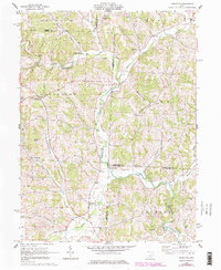
1962 Map of Perryton
USGS Topo · Published 1978About this map
The rolling drainage basins of Wakatomika Creek and its many tributaries, including Winding Fork and Nickel Valley Run, characterize this portion of eastern Ohio. In the early 1960s, small rural settlements like Fallsburg, Perryton, and Tilton Crossroads served as the primary hubs for this agricultural and woodland landscape. The map shows a high concentration of community landmarks, including the Perry Chapel, the Mount Pleasant Ch, and several family or community burying grounds such as Robinson Cem and Norris Cem. Transportation through the varied terrain relied on numerous crossings, ranging from a traditional Covered Bridge near Frampton to engineered structures like Moran Bridge and Patterson Bridge. This survey captures the region just before later 20th-century revisions, documenting the placement of remote homesteads and the Perry Sch in a period of relative rural stability.
Find a feature on this map
40 named features on this map. Tap any name to fly to it.
Don’t see what you’re looking for? This feature index may not catch every label — zoom into the map to look around manually.
Map Details
Editions of this 1962 Perryton Map
3 editions found
Other maps of this area

1909 · Newark
USGS Topo · 1:62,500

1910 · Frazeysburg
USGS Topo · 1:62,500

1912 · Gambier
USGS Topo · 1:62,500

1913 · Brinkhaven
USGS Topo · 1:62,500

1914 · Gambier
USGS Topo · 1:62,500

1915 · Brinkhaven
USGS Topo · 1:62,500

1943 · Gambier
USGS Topo · 1:62,500

1950 · Marion
USGS Topo · 1:250,000

1961 · Hanover
USGS Topo · 1:24,000
1961 · Walhonding
USGS Topo · 1:24,000