
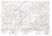
1954 Map of Perryton
USGS Topo · Published 1966About this map
The High Plains of the Texas and Oklahoma panhandles meet along the Cimarron Base Line in this mid-century survey of a landscape defined by ranching, rail, and the emerging energy economy. The regional infrastructure is anchored by the Chicago Rock Island and Pacific and the Atchison Topeka and Santa Fe railroads, which connect agricultural hubs like Perryton, Guymon, and Spearman. Significant educational and industrial landmarks are present, including the Panhandle A & M College in Oklahoma and the Cactus Ordnance Works to the southwest. Natural features like the Cimarron River and the shifting Beaver Meade and Englewood Dunes contrast with the grid-like expansion of gas wells and pipelines. Small community centers such as Slapout, Forgan, and Hooker serve as essential outposts across this open prairie terrain.
Find a feature on this map
85 named features on this map. Tap any name to fly to it.
Don’t see what you’re looking for? This feature index may not catch every label — zoom into the map to look around manually.
Map Details
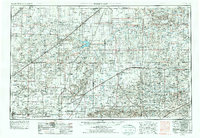
Editions of this 1954 Perryton Map
3 editions found
Other maps of this area

1892 · Meade
USGS Topo · 1:125,000

1892 · Vilas
USGS Topo · 1:125,000

1896 · Ashland
USGS Topo · 1:125,000

1953 · Stinnett Station
USGS Topo · 1:24,000

1953 · Pringle
USGS Topo · 1:24,000

1954 · Tucumcari
USGS Topo · 1:250,000

1954 · Amarillo
USGS Topo · 1:250,000

1954 · Dalhart
USGS Topo · 1:250,000

1955 · Clinton
USGS Topo · 1:250,000

1955 · La Junta
USGS Topo · 1:250,000