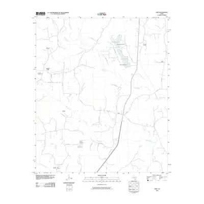
2010 Map of Pert
USGS Topo · Published 2010About this map
The community of Pert serves as the central hub for this portion of Anderson County, where a network of county roads like Co RD 436 and Co RD 435 connects scattered rural homesteads and agricultural tracts. This 2010 survey reflects a landscape defined by its water management and ancestral grounds, featuring numerous small reservoirs such as Lake Frankston, Pineywoods Lake, and Charles E Ham Lake. These man-made water bodies, often formed by private dams, sit alongside natural drainages like Walnut Creek and Brushy Creek.
Find a feature on this map
55 named features on this map. Tap any name to fly to it.
Don’t see what you’re looking for? This feature index may not catch every label — zoom into the map to look around manually.
Map Details
Editions of this 2010 Pert Map
This is the sole edition of this map. No revisions or reprints were ever made.
Other maps of this area

1946 · Bullard
USGS Topo · 1:62,500

1948 · Bullard
USGS Topo · 1:62,500

1949 · Palestine
USGS Topo · 1:62,500

1949 · Frankston
USGS Topo · 1:62,500

1950 · Palestine
USGS Topo · 1:62,500

1950 · Frankston
USGS Topo · 1:62,500

1951 · Jacksonville
USGS Topo · 1:62,500

1953 · Palestine
USGS Topo · 1:250,000

1956 · Tyler
USGS Topo · 1:250,000

1957 · Palestine
USGS Topo · 1:250,000