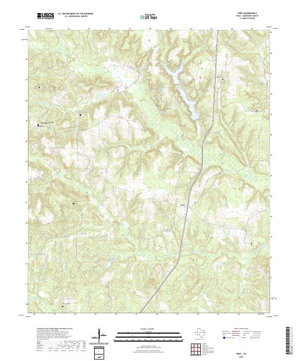
2022 Map of Pert
USGS Topo · Published 2022About this map
Brushy Creek and the surrounding Anderson County countryside characterize this landscape, where family legacy is preserved through numerous small burial grounds and rural homesteads. The terrain is defined by a dense network of tributaries including Indian Cr, Little Brushy Cr, and Walnut Cr, which carve through the woodlands and pastures of East Texas. The small settlement of Pert serves as a local waypoint along Highway 155, while the presence of Bethel Cem, Olive Branch Cem, and Pisgah Cem highlights the area's deep-rooted community history. Further south, the map identifies the Lawrence Cem near Mound Prairie Cr and Charles E Ham Lake. This collection of small family and community cemeteries provides essential spatial data for genealogists tracing ancestral homesteads in the region's agricultural landscape.
Find a feature on this map
73 named features on this map. Tap any name to fly to it.
Don’t see what you’re looking for? This feature index may not catch every label — zoom into the map to look around manually.
Map Details
Editions of this 2022 Pert Map
This is the sole edition of this map. No revisions or reprints were ever made.
Other maps of this area

1946 · Bullard
USGS Topo · 1:62,500

1948 · Bullard
USGS Topo · 1:62,500

1949 · Palestine
USGS Topo · 1:62,500

1949 · Frankston
USGS Topo · 1:62,500

1950 · Palestine
USGS Topo · 1:62,500

1950 · Frankston
USGS Topo · 1:62,500

1951 · Jacksonville
USGS Topo · 1:62,500

1953 · Palestine
USGS Topo · 1:250,000

1956 · Tyler
USGS Topo · 1:250,000

1957 · Palestine
USGS Topo · 1:250,000