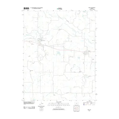
2010 Map of Peru
USGS Topo · Published 2010About this map
Peru and Niotaze anchor this landscape in southeastern Chautauqua County, where the low elevations of the Chautauqua Hills meet a dense network of prairie waterways. The drainage pattern is dominated by the Middle Caney Creek, Little Caney River, and several smaller tributaries like Birch Creek and Thunderbolt Creek that feed toward the Hulah Reservoir just across the southern boundary. This 2010 survey illustrates the continued importance of the energy industry to the local economy, evidenced by the Niotaze Oil Field located south of the town site.
Find a feature on this map
37 named features on this map. Tap any name to fly to it.
Don’t see what you’re looking for? This feature index may not catch every label — zoom into the map to look around manually.
Map Details
Editions of this 2010 Peru Map
This is the sole edition of this map. No revisions or reprints were ever made.
Other maps of this area

1885 · Sedan
USGS Topo · 1:125,000

1886 · Independence
USGS Topo · 1:125,000

1889 · Sedan
USGS Topo · 1:125,000

1894 · Independence
USGS Topo · 1:125,000

1901 · Nowata
USGS Topo · 1:125,000

1905 · Independence
USGS Topo · 1:125,000

1909 · Pawhuska
USGS Topo · 1:125,000

1910 · Pawhuska
USGS Topo · 1:125,000

1914 · Nowata
USGS Topo · 1:125,000

1947 · Joplin
USGS Topo · 1:250,000