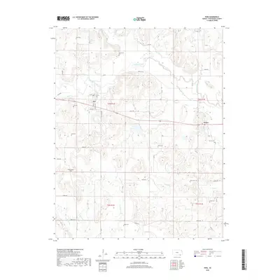
2018 Map of Peru
USGS Topo · Published 2018About this map
Peru and Niotaze anchor this portrait of southeastern Chautauqua County, where the southern reaches of the Chautauqua Hills meet a dense network of watercourses. The landscape is defined by the winding path of the Little Caney River and its numerous tributaries, including Middle Caney Creek, Birch Cr, and Coon Cr. This 2018 survey reveals a rural landscape deeply connected to its local heritage, evidenced by a high density of small cemeteries scattered throughout the townships, such as Alford Cem, Lerado Cem, and Mooney Cem. The grid of county roads, including Indian Rd and Gallop Rd, navigates the complex terrain of the hills, while the town of Peru maintains its traditional layout with named streets like S Merchant St and Wilson St. For researchers, the map provides a contemporary look at land divisions and long-established burial sites that remain central to the region's identity.
Find a feature on this map
49 named features on this map. Tap any name to fly to it.
Don’t see what you’re looking for? This feature index may not catch every label — zoom into the map to look around manually.
Map Details
Editions of this 2018 Peru Map
This is the sole edition of this map. No revisions or reprints were ever made.
Other maps of this area

1885 · Sedan
USGS Topo · 1:125,000

1886 · Independence
USGS Topo · 1:125,000

1889 · Sedan
USGS Topo · 1:125,000

1894 · Independence
USGS Topo · 1:125,000

1901 · Nowata
USGS Topo · 1:125,000

1905 · Independence
USGS Topo · 1:125,000

1909 · Pawhuska
USGS Topo · 1:125,000

1910 · Pawhuska
USGS Topo · 1:125,000

1914 · Nowata
USGS Topo · 1:125,000

1947 · Joplin
USGS Topo · 1:250,000