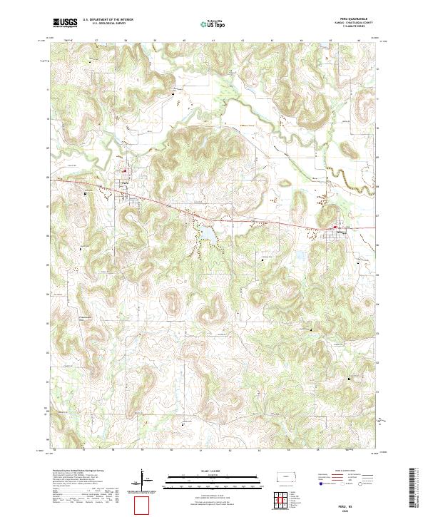
2022 Map of Peru
USGS Topo · Published 2022About this map
Chautauqua Hills define the rolling landscape of this region, where the town of Peru and the village of Niotaze sit along the central corridor. The terrain is deeply marked by a network of drainage systems, including the Little Caney River and Middle Caney Creek, which wind through the township boundaries of T34S and T35S. This 2022 survey captures a rural landscape still anchored by its historic cemeteries and small-scale road network.
Find a feature on this map
46 named features on this map. Tap any name to fly to it.
Don’t see what you’re looking for? This feature index may not catch every label — zoom into the map to look around manually.
Map Details
Editions of this 2022 Peru Map
This is the sole edition of this map. No revisions or reprints were ever made.
Other maps of this area

1885 · Sedan
USGS Topo · 1:125,000

1886 · Independence
USGS Topo · 1:125,000

1889 · Sedan
USGS Topo · 1:125,000

1894 · Independence
USGS Topo · 1:125,000

1901 · Nowata
USGS Topo · 1:125,000

1905 · Independence
USGS Topo · 1:125,000

1909 · Pawhuska
USGS Topo · 1:125,000

1910 · Pawhuska
USGS Topo · 1:125,000

1914 · Nowata
USGS Topo · 1:125,000

1947 · Joplin
USGS Topo · 1:250,000