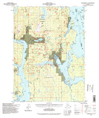
1994 Map of Petersburg A-4
USGS Topo · Published 1998About this map
Prince of Wales Island and the dense forest lands of the Tongass National Forest dominate this maritime landscape during the late twentieth century. The map highlights a region defined by complex waterways and timber management, featuring specialized infrastructure like the Log Transfer Facility and the El Capitan Work Center. Fringed by the Clarence Strait and Whale Passage, the terrain is marked by distinctive geological features including Cavern Lake and the karst-inflected Sink Hole Lake. Human presence is largely oriented around the water, evidenced by Camp Taylor (Site) on Sarheen Cove and various cabins near Whale Pass. This survey illustrates the intricate balance between industrial timber access and the preservation of areas like the Land Use Development II Management Area and the Mt Calder / Mt Holbrook Land Use Development II Management Area.
Find a feature on this map
47 named features on this map. Tap any name to fly to it.
Don’t see what you’re looking for? This feature index may not catch every label — zoom into the map to look around manually.
Map Details
Editions of this 1994 Petersburg A-4 Map
This is the sole edition of this map. No revisions or reprints were ever made.
Other maps of this area

1948 · Petersburg B-3
USGS Topo · 1:63,360

1949 · Craig D-3
USGS Topo · 1:63,360

1949 · Petersburg B-5
USGS Topo · 1:63,360

1949 · Petersburg A-3
USGS Topo · 1:63,360

1949 · Craig D-4
USGS Topo · 1:63,360

1949 · Petersburg A-5
USGS Topo · 1:63,360

1949 · Petersburg A-4
USGS Topo · 1:63,360

1949 · Petersburg B-4
USGS Topo · 1:63,360

1950 · Craig D-3
USGS Topo · 1:63,360

1951 · Craig D-5
USGS Topo · 1:63,360