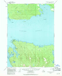
1949 Map of Petersburg B-5
USGS Topo · Published 1971About this map
Sumner Strait divides the northern and southern halves of this topographic study, separating the southern shore of Kupreanof Island from the northern tip of Prince of Wales Island. Small fishing and maritime outposts like Pt Baker and Port Protection are documented during a period of transition in the mid-twentieth century, showing a landscape defined by its reliance on water-based transport. The presence of a Seaplane Base near Wooden Wheel Cove underscores the essential role of aviation in reaching these isolated coastal communities. Inland, the terrain is characterized by complex drainages and numerous water bodies, including Kushneahin Lake and Barrie Lake. The map reveals a rugged coastline indented by deep inlets such as Labouchere Bay and unique landmarks like Hole-in-the-Wall, while numerous islands including Shingle I and Yellow I pepper the surrounding waters of Totem Bay.
Find a feature on this map
44 named features on this map. Tap any name to fly to it.
Don’t see what you’re looking for? This feature index may not catch every label — zoom into the map to look around manually.
Map Details
Editions of this 1949 Petersburg B-5 Map
3 editions found
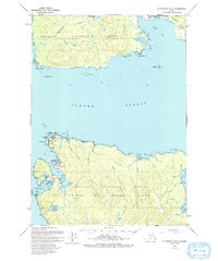
Other maps of this area

1948 · Petersburg A-6
USGS Topo · 1:63,360

1948 · Petersburg C-4
USGS Topo · 1:63,360

1948 · Petersburg B-6
USGS Topo · 1:63,360

1948 · Petersburg C-6
USGS Topo · 1:63,360

1948 · Petersburg C-5
USGS Topo · 1:63,360

1949 · Petersburg B-5
USGS Topo · 1:63,360

1949 · Petersburg A-5
USGS Topo · 1:63,360

1949 · Petersburg A-4
USGS Topo · 1:63,360

1949 · Petersburg B-4
USGS Topo · 1:63,360

1951 · Petersburg B-4
USGS Topo · 1:63,360