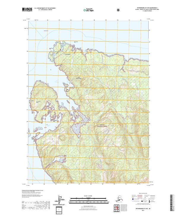
2021 Map of Petersburg B-5 SW
USGS Topo · Published 2021About this map
Point Baker and Port Protection anchor the northern coastline of Prince of Wales Island in this contemporary look at the Alexander Archipelago. This portion of the Tongass National Forest is defined by a labyrinth of inlets and small islands, including Joe Mace Island and Jackson Island. The landscape transitions from the marine-facing Sumner Strait to the high elevations of Flicker Ridge, where specialized forest roads and trails like the Flicker Ridge Trl provide access to the interior. Further south, the settlement at Labouchere Bay sits near distinctive coastal landmarks like Protection Head and White Bluff. The intricate network of forest service spurs, such as the Memorial Beach system and North Prince of Wales Road, reflects the modern balance of maritime commerce and timber management in this isolated maritime environment.
Find a feature on this map
51 named features on this map. Tap any name to fly to it.
Don’t see what you’re looking for? This feature index may not catch every label — zoom into the map to look around manually.
Map Details
Editions of this 2021 Petersburg B-5 SW Map
This is the sole edition of this map. No revisions or reprints were ever made.
Other maps of this area

1948 · Petersburg A-6
USGS Topo · 1:63,360

1948 · Petersburg B-6
USGS Topo · 1:63,360

1949 · Petersburg B-5
USGS Topo · 1:63,360

1949 · Petersburg A-5
USGS Topo · 1:63,360

1951 · Petersburg B-6
USGS Topo · 1:63,360

1951 · Petersburg A-6
USGS Topo · 1:63,360

1952 · Petersburg
USGS Topo · 1:250,000
1953 · Petersburg B-5
USGS Topo · 1:63,360

1953 · Petersburg A-5
USGS Topo · 1:63,360

1960 · Petersburg
USGS Topo · 1:250,000