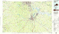
1984 Map of Petersburg
USGS Topo · Published 1985About this map
The James River and Appomattox River define the industrial and civic heart of this mid-1980s Virginia landscape, where the urban centers of Richmond, Petersburg, Hopewell, and Colonial Heights converge. The mapping reveals a region deeply tied to its military and commemorative heritage, anchored by the Fort Lee Military Reservation and the sprawling Fort Pickett Military Reservation in the southwest. Extensive preserved lands, such as Petersburg National Battlefield and the Glendale Nat Cem, underscore the area's significance in American history.
Find a feature on this map
138 named features on this map. Tap any name to fly to it.
Don’t see what you’re looking for? This feature index may not catch every label — zoom into the map to look around manually.
Map Details
Editions of this 1984 Petersburg Map
2 editions found
Other maps of this area

1890 · Goochland
USGS Topo · 1:125,000

1891 · Palmyra
USGS Topo · 1:125,000

1891 · Farmville
USGS Topo · 1:125,000

1892 · Goochland
USGS Topo · 1:125,000

1893 · Farmville
USGS Topo · 1:125,000

1894 · Bermuda Hundred
USGS Topo · 1:62,500

1894 · Petersburg
USGS Topo · 1:62,500

1894 · Richmond
USGS Topo · 1:62,500

1895 · Richmond
USGS Topo · 1:62,500

1895 · Palmyra
USGS Topo · 1:125,000