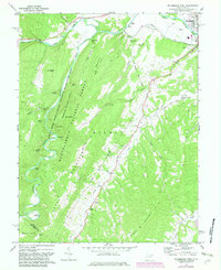
1969 Map of Petersburg West
USGS Topo · Published 1982About this map
South Br Potomac River and the North Fork River converge near the established settlement of Petersburg, where the Grant Co Airport and Petersburg Fish Hatchery reflect the mid-century infrastructure of the region. The landscape is dominated by the steep ridges of Cave Mountain and Big Mountain, much of which is preserved within the Monongahela National Forest. Rural life is centered around isolated mountain gaps and small communities like Cabins, Pansy, and Landes. The map reveals a high density of country churches and small family cemeteries, such as Marvin Chapel and St Johns Ch, scattered along the drainage of Mill Creek and Johnson Run. Within the Spruce Knob-Seneca Rocks National Recreation Area, geological landmarks like Peacock Cave and Castle Rock highlight the distinctive topography of the Potomac highlands.
Find a feature on this map
48 named features on this map. Tap any name to fly to it.
Don’t see what you’re looking for? This feature index may not catch every label — zoom into the map to look around manually.
Map Details
Editions of this 1969 Petersburg West Map
4 editions found
Other maps of this area

1892 · Franklin
USGS Topo · 1:125,000

1895 · Piedmont
USGS Topo · 1:125,000

1896 · Franklin
USGS Topo · 1:125,000

1916 · Davis
USGS Topo · 1:48,000

1918 · Davis
USGS Topo · 1:62,500

1919 · Davis
USGS Topo · 1:62,500

1920 · Davis
USGS Topo · 1:48,000

1920 · Petersburg
USGS Topo · 1:48,000

1920 · Onego
USGS Topo · 1:62,500

1921 · Petersburg
USGS Topo · 1:48,000