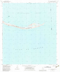
1982 Map of Petit Bois Island
USGS Topo · Published 1983About this map
Petit Bois Island stretches across the boundary between Mississippi and Alabama, serving as a narrow barrier between the Mississippi Sound and the open Gulf of Mexico. This 1982 survey, compiled from data by the Department of the Interior and the Geological Survey, documents the island as part of the Gulf Islands National Seashore. The map captures the shifting topography of the shoreline, noting maritime navigation aids like the Horn Island Lighthouse and markers along the Intracoastal Waterway to the north. Strategically located within Jackson and Mobile Counties, the island's low-lying terrain is punctuated by marshes and small ponds, illustrating the fragile geography of the Gulf coast before late-twentieth-century storm cycles further altered its shape.
Find a feature on this map
11 named features on this map. Tap any name to fly to it.
Don’t see what you’re looking for? This feature index may not catch every label — zoom into the map to look around manually.
Map Details
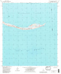
Editions of this 1982 Petit Bois Island Map
2 editions found
Other maps of this area

1921 · Grand Bay
USGS Topo · 1:62,500

1921 · Petit Bois Island
USGS Topo · 1:62,500

1941 · Horn Island
USGS Topo · 1:62,500

1942 · Petit Bois Island
USGS Topo · 1:62,500

1942 · Horn Island
USGS Topo · 1:62,500

1943 · Pascagoula
USGS Topo · 1:62,500

1943 · Grand Bay
USGS Topo · 1:62,500

1953 · Mobile
USGS Topo · 1:250,000

1955 · Pascagoula
USGS Topo · 1:62,500

1957 · Mobile
USGS Topo · 1:250,000