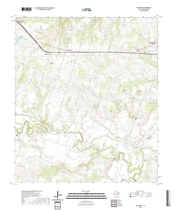
2022 Map of Pettibone
USGS Topo · Published 2022About this map
Pettibone and the surrounding Milam County countryside are defined by the convergence of the Little River and the San Gabriel River, a landscape of winding sloughs and creeks. This 2022 survey documents a rural environment heavily marked by family and community history, evidenced by a high density of small cemeteries. Genealogists and local historians can trace the locations of several burial grounds, including the Salem - Wilson Cem, Riverside Cem, and the Ad Hall Cem. The settlement pattern follows the local drainage and early road network, with Buckholts sitting at the northwestern edge and the larger town of Cameron appearing to the northeast. Notable water features like Ackerman Slough and Wolf Spring Slough illustrate the complex hydrology of the river bottomlands, where oxbows and seasonal lakes like Hlavacek Lake and Randle Lake punctuate the terrain between Indian and Hall Hollows.
Find a feature on this map
59 named features on this map. Tap any name to fly to it.
Don’t see what you’re looking for? This feature index may not catch every label — zoom into the map to look around manually.
Map Details
Editions of this 2022 Pettibone Map
This is the sole edition of this map. No revisions or reprints were ever made.
Other maps of this area

1885 · Taylor
USGS Topo · 1:125,000

1887 · Taylor
USGS Topo · 1:125,000

1894 · Taylor
USGS Topo · 1:125,000

1910 · Buckholts
USGS Topo · 1:24,000

1912 · Buckholts
USGS Topo · 1:31,680

1954 · Austin
USGS Topo · 1:250,000

1956 · Milano
USGS Topo · 1:62,500

1961 · Cameron
USGS Topo · 1:24,000

1961 · Rockdale East
USGS Topo · 1:24,000

1962 · Rockdale West
USGS Topo · 1:24,000