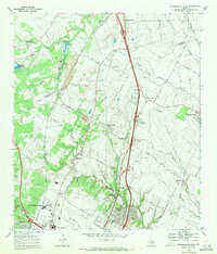
1968 Map of Pflugerville West
USGS Topo · Published 1971About this map
University of Texas Balcones Research Center and a complex network of railroads define this landscape north of Austin during the late 1960s. The geography is tied to the transit corridors of the Missouri Pacific, Southern Pacific, and Missouri Kansas Texas railroads, which influenced the distribution of small communities like McNeil, Merrelltown, and Waters Park. These tracks weave through a limestone-rich area marked by several quarries and gravel pits, indicating the region's industrial foundations before widespread suburban expansion.
Find a feature on this map
59 named features on this map. Tap any name to fly to it.
Don’t see what you’re looking for? This feature index may not catch every label — zoom into the map to look around manually.
Map Details
Editions of this 1968 Pflugerville West Map
2 editions found
Other maps of this area

1893 · Georgetown
USGS Topo · 1:125,000

1896 · Austin
USGS Topo · 1:125,000

1897 · Austin
USGS Topo · 1:125,000

1910 · Austin
USGS Topo · 1:125,000

1925 · Georgetown 4-d
USGS Topo · 1:48,000

1928 · Round Rock
USGS Topo · 1:62,500

1932 · Mt. Bonnell
USGS Topo · 1:62,500

1949 · Round Rock
USGS Topo · 1:62,500

1951 · Round Rock
USGS Topo · 1:62,500

1954 · Austin East
USGS Topo · 1:24,000