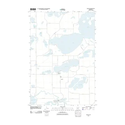
2010 Map of Phelps
USGS Topo · Published 2010About this map
The Otter Tail River winds through this central Minnesota landscape, punctuated by the Phelps Mill Bridge and the Otter Tail River Dam at the settlement of Phelps. This area of Otter Tail County is defined by its high density of glacial lakes, including the expansive Dead Lake, Pickerel Lake, and Star Lake. The road network connects the small communities of Phelps and Maine, providing access to numerous residential clusters along the lakefronts, such as those found on Birchwood Shore Dr. Local history is preserved at sites like the Saint James Catholic Church Cemetery and Silent Vale Cemetery, while the river remains a central corridor for the region's geography and infrastructure.
Find a feature on this map
57 named features on this map. Tap any name to fly to it.
Don’t see what you’re looking for? This feature index may not catch every label — zoom into the map to look around manually.
Map Details
Editions of this 2010 Phelps Map
This is the sole edition of this map. No revisions or reprints were ever made.
Other maps of this area

1912 · Vergas
USGS Topo · 1:62,500

1912 · Battle Lake
USGS Topo · 1:62,500

1914 · Battle Lake
USGS Topo · 1:62,500

1915 · Underwood
USGS Topo · 1:62,500

1915 · Perham
USGS Topo · 1:62,500

1915 · Vergas
USGS Topo · 1:62,500

1953 · Brainerd
USGS Topo · 1:250,000

1957 · Brainerd
USGS Topo · 1:250,000

1958 · Brainerd
USGS Topo · 1:250,000

1965 · Brainerd
USGS Topo · 1:250,000