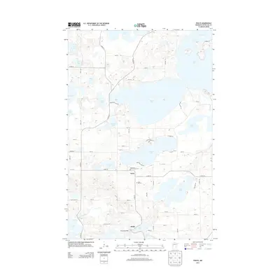
2013 Map of Phelps
USGS Topo · Published 2013About this map
The Otter Tail River winds through this lake-heavy landscape in Otter Tail County, anchoring the small communities of Maine and Phelps. The river's historical importance to local industry is evidenced by the Phelps Mill Bridge, situated near the southern edge of the quadrangle. This area is characterized by a dense concentration of glacial water bodies, ranging from the expansive Dead Lake and Star Lake to smaller basins like Pickerel Lake and Leon Lake. Settlement patterns follow the shorelines and riverbanks, with rural road networks connecting family-named landmarks and local sites. Genealogists will find significant local history at the Saint James Catholic Church Cem and the Silent Vale Cem, which serve the surrounding rural population. The geography is defined by the transition between major lakes, connected by waterways such as the Dead River, reflecting the region's enduring reliance on its aquatic resources.
Find a feature on this map
56 named features on this map. Tap any name to fly to it.
Don’t see what you’re looking for? This feature index may not catch every label — zoom into the map to look around manually.
Map Details
Editions of this 2013 Phelps Map
This is the sole edition of this map. No revisions or reprints were ever made.
Other maps of this area

1912 · Vergas
USGS Topo · 1:62,500

1912 · Battle Lake
USGS Topo · 1:62,500

1914 · Battle Lake
USGS Topo · 1:62,500

1915 · Underwood
USGS Topo · 1:62,500

1915 · Perham
USGS Topo · 1:62,500

1915 · Vergas
USGS Topo · 1:62,500

1953 · Brainerd
USGS Topo · 1:250,000

1957 · Brainerd
USGS Topo · 1:250,000

1958 · Brainerd
USGS Topo · 1:250,000

1965 · Brainerd
USGS Topo · 1:250,000