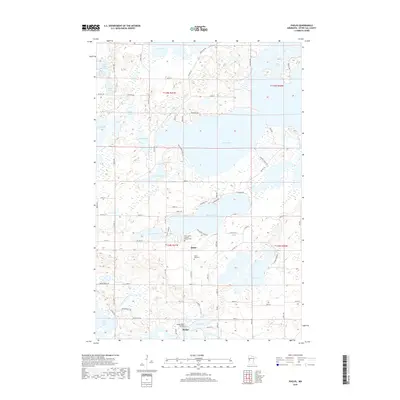
2019 Map of Phelps
USGS Topo · Published 2019About this map
Maine and the small settlement of Phelps anchor this landscape of the glacial lake country in Otter Tail County. The area is defined by a dense network of water bodies, most notably the expansive Dead Lake and Pickerel Lake, which are connected by the winding course of the Dead River. This 2019 survey documents a region where the natural hydrography shaped early development, evidenced by the location of the Phelps Mill Bridge along the Otter Tail River. Genealogists and local researchers will find significant landmarks such as the Saint James Catholic Church Cem and Silent Vale Cem, which serve as physical links to the community's heritage. The map also traces modern thoroughfares like Co Hwy 74 and Brightwood Shore Dr as they navigate the irregular shorelines of Star Lake, Round Lake, and Twin Lakes.
Find a feature on this map
78 named features on this map. Tap any name to fly to it.
Don’t see what you’re looking for? This feature index may not catch every label — zoom into the map to look around manually.
Map Details
Editions of this 2019 Phelps Map
This is the sole edition of this map. No revisions or reprints were ever made.
Other maps of this area

1912 · Vergas
USGS Topo · 1:62,500

1912 · Battle Lake
USGS Topo · 1:62,500

1914 · Battle Lake
USGS Topo · 1:62,500

1915 · Underwood
USGS Topo · 1:62,500

1915 · Perham
USGS Topo · 1:62,500

1915 · Vergas
USGS Topo · 1:62,500

1953 · Brainerd
USGS Topo · 1:250,000

1957 · Brainerd
USGS Topo · 1:250,000

1958 · Brainerd
USGS Topo · 1:250,000

1965 · Brainerd
USGS Topo · 1:250,000