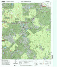
1997 Map of Phelps
USGS Topo · Published 2000About this map
The Sam Houston National Forest covers much of this Walker County landscape, where the settlement of Phelps serves as a central junction. The map documents a mix of institutional and industrial land use, including the State Prison Farm (Goree) near the State Fish Hatchery and the Morian-Sam Houston Oil Field to the north. For genealogists and local historians, several community sites are noted, such as Everlena Church and the Grant Colony Cemetery. Traces of earlier habitations appear as the Harmony and Mount Moriah sites, while the timber industry is represented by a Sawmill near Warren Church. The terrain is defined by a dense network of watercourses, including Harmon Creek and Winters Creek, which drain the heavily wooded area known as Four Notch.
Find a feature on this map
44 named features on this map. Tap any name to fly to it.
Don’t see what you’re looking for? This feature index may not catch every label — zoom into the map to look around manually.
Map Details
Editions of this 1997 Phelps Map
This is the sole edition of this map. No revisions or reprints were ever made.
Other maps of this area

1954 · Beaumont
USGS Topo · 1:250,000

1957 · Beaumont
USGS Topo · 1:250,000

1959 · Moore Grove
USGS Topo · 1:24,000

1960 · Maynard
USGS Topo · 1:24,000

1960 · New Waverly
USGS Topo · 1:24,000

1960 · Phelps
USGS Topo · 1:24,000

1961 · Staley
USGS Topo · 1:24,000

1961 · Riverside
USGS Topo · 1:24,000

1961 · Oakhurst
USGS Topo · 1:24,000

1962 · Pine Prairie
USGS Topo · 1:24,000