
1971 Map of Philip Smith Mountains B-3
USGS Topo · Published 1974About this map
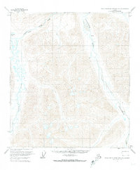
The Continental Divide defines the watershed and high country of the Philip Smith Mountains in this 1971 field-annotated survey. This Brooks Range landscape is anchored by Cloud Peak and is a study in Arctic hydrology, where the northern slopes drain into the Sagavanirktok River and Accomplishment Creek, while the southern reaches feed the Middle Fork Chandalar River. Produced from 1970 aerial photography, the map captures a remote section of the North Slope just as modern surveying and resource exploration were beginning to map the interior in greater detail. The absence of roads or trails highlights the isolation of this high-latitude terrain, where topographic lines reveal the steep elevation changes and drainage patterns that dictate movement through the mountains.
Find a feature on this map
5 named features on this map. Tap any name to fly to it.
Don’t see what you’re looking for? This feature index may not catch every label — zoom into the map to look around manually.
Map Details
Editions of this 1971 Philip Smith Mountains B-3 Map
This is the sole edition of this map. No revisions or reprints were ever made.
Other maps of this area

1951 · Brooks
USGS Topo · 1:250,000

1956 · Philip Smith Mountains
USGS Topo · 1:250,000

1964 · Philip Smith Mountains
USGS Topo · 1:250,000
1971 · Philip Smith Mountains A-4
USGS Topo · 1:63,360

1971 · Philip Smith Mountains C-4
USGS Topo · 1:63,360
1971 · Philip Smith Mountains C-2
USGS Topo · 1:63,360
1971 · Philip Smith Mountains C-3
USGS Topo · 1:63,360
1971 · Philip Smith Mountains A-2
USGS Topo · 1:63,360
1971 · Philip Smith Mountains B-4
USGS Topo · 1:63,360
1971 · Philip Smith Mountains A-3
USGS Topo · 1:63,360