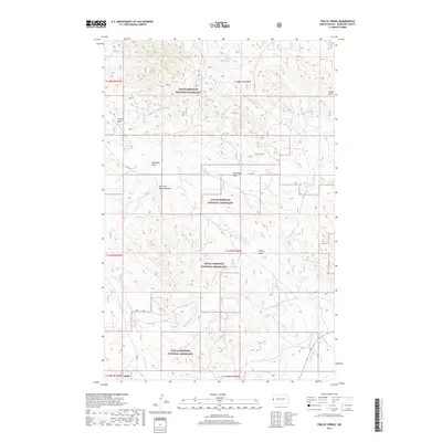
2017 Map of Phillip Spring
USGS Topo · Published 2017About this map
Little Missouri National Grassland dominates this portion of McKenzie County, North Dakota, where the intricate network of the Badlands landscape is revealed through a dense system of draws and seasonal water sources. The map identifies specific geographical markers such as Phillip Spring and McPeak Spring, which were vital watering points in this arid region. The drainage patterns of Bennie Peer Cr and One-O-One Cr illustrate how water has carved the local terrain over millennia, creating the deeply etched features like Badlands Draw and Corral Draw. Only a single maintained road, Co RD 38, transects this remote area, highlighting the preservation of the landscape within the national grassland. For those tracing the environmental history of North Dakota, this sheet provides a meticulous record of named topographical features and section boundaries within the Public Land Survey System.
Find a feature on this map
22 named features on this map. Tap any name to fly to it.
Don’t see what you’re looking for? This feature index may not catch every label — zoom into the map to look around manually.
Map Details
Editions of this 2017 Phillip Spring Map
This is the sole edition of this map. No revisions or reprints were ever made.
Other maps of this area

1909 · Glendive
USGS Topo · 1:250,000

1953 · Watford City
USGS Topo · 1:250,000

1954 · Glendive
USGS Topo · 1:250,000

1957 · Glendive
USGS Topo · 1:250,000

1957 · Watford City
USGS Topo · 1:250,000

1958 · Glendive
USGS Topo · 1:250,000

1966 · Sidney NE
USGS Topo · 1:24,000

1967 · Watford City
USGS Topo · 1:250,000

1972 · Horse Creek School
USGS Topo · 1:24,000

1972 · Sidney SE
USGS Topo · 1:24,000