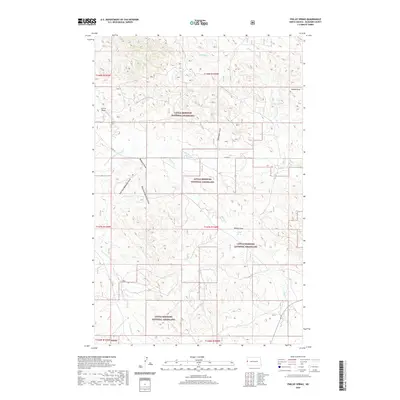
2020 Map of Phillip Spring
USGS Topo · Published 2020About this map
The Little Missouri National Grassland dominates this corner of McKenzie County, revealing a complex network of ephemeral drainages and vital water sources in the western North Dakota landscape. The map centers on significant topographic depressions such as Badlands Draw, which is fed by the East Fork Badlands Draw and West Fork Badlands Draw. These features, along with Phillip Draw and Rommingen Draw, illustrate the highly eroded nature of the badlands terrain. For local historians and researchers, the presence of named water sources like Phillip Spring, Klandl Spring, and McPeak Spring highlights the historical importance of localized water points for ranching and livestock in this semi-arid environment. Infrastructure is sparse, characterized largely by section lines and Co RD 38, which navigates the draws and creek beds including Bennie Peer Cr and One-O-One Cr.
Find a feature on this map
22 named features on this map. Tap any name to fly to it.
Don’t see what you’re looking for? This feature index may not catch every label — zoom into the map to look around manually.
Map Details
Editions of this 2020 Phillip Spring Map
This is the sole edition of this map. No revisions or reprints were ever made.
Other maps of this area

1909 · Glendive
USGS Topo · 1:250,000

1953 · Watford City
USGS Topo · 1:250,000

1954 · Glendive
USGS Topo · 1:250,000

1957 · Glendive
USGS Topo · 1:250,000

1957 · Watford City
USGS Topo · 1:250,000

1958 · Glendive
USGS Topo · 1:250,000

1966 · Sidney NE
USGS Topo · 1:24,000

1967 · Watford City
USGS Topo · 1:250,000

1972 · Horse Creek School
USGS Topo · 1:24,000

1972 · Sidney SE
USGS Topo · 1:24,000