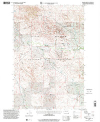
1997 Map of Phillip Spring
USGS Topo · Published 2001About this map
Little Missouri National Grassland dominates this corner of McKenzie County, revealing a landscape defined by ranching and energy extraction in the late twentieth century. Family heritage is deeply etched into the topography through scattered operations like the Wheeling-Hatter Ranch, D Hatter Ranch, and T Dwyer Jr Ranch. These private holdings sit alongside the industrial footprint of the Mondak Oil Field, where numerous well sites, a Gas Plant, and tank batteries indicate a robust subterranean economy. Water sources, vital for livestock in this arid terrain, are meticulously documented, from the namesake Phillip Spring to the winding courses of One-O-One Creek and Bennie Creek. The complex drainage patterns of Badlands Draw and Corral Draw illustrate the erosion-carved character of the North Dakota badlands during this era of USDA Forest Service management.
Find a feature on this map
21 named features on this map. Tap any name to fly to it.
Don’t see what you’re looking for? This feature index may not catch every label — zoom into the map to look around manually.
Map Details
Editions of this 1997 Phillip Spring Map
This is the sole edition of this map. No revisions or reprints were ever made.
Other maps of this area

1909 · Glendive
USGS Topo · 1:250,000

1953 · Watford City
USGS Topo · 1:250,000

1954 · Glendive
USGS Topo · 1:250,000

1957 · Glendive
USGS Topo · 1:250,000

1957 · Watford City
USGS Topo · 1:250,000

1958 · Glendive
USGS Topo · 1:250,000

1966 · Sidney NE
USGS Topo · 1:24,000

1967 · Watford City
USGS Topo · 1:250,000

1972 · Horse Creek School
USGS Topo · 1:24,000

1972 · Sidney SE
USGS Topo · 1:24,000