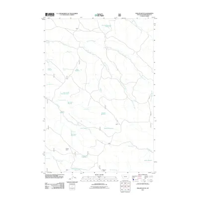
2011 Map of Phillips Butte
USGS Topo · Published 2011About this map
Phillips Butte and Diamond Butte define the topography of this cattle-country landscape in Powder River County, Montana. The land is characterized by an extensive system of natural springs and managed water catchments essential for ranching, including the Lyon Creek Divide Reservoir and Elk Creek Reservoir Number One. Numerous smaller features such as Mud Turtle Spring, Schwind Spring, and Coal Mine Spring suggest the location of historic watering holes and small-scale resource extraction. The drainage network is anchored by Lyon Creek and the forks of North Fork and South Fork Elk Creek, while Bonnette Rd provides one of the few named transit corridors through this open range. This 2011 survey documents a modern snapshot of a working landscape where water rights and terrain dictate the pattern of human activity.
Find a feature on this map
37 named features on this map. Tap any name to fly to it.
Don’t see what you’re looking for? This feature index may not catch every label — zoom into the map to look around manually.
Map Details
Editions of this 2011 Phillips Butte Map
This is the sole edition of this map. No revisions or reprints were ever made.
Other maps of this area

1954 · Hardin
USGS Topo · 1:250,000

1954 · Ekalaka
USGS Topo · 1:250,000

1956 · Ekalaka
USGS Topo · 1:250,000

1957 · Hardin
USGS Topo · 1:250,000

1958 · Ekalaka
USGS Topo · 1:250,000

1958 · Hardin
USGS Topo · 1:250,000

1965 · Ekalaka
USGS Topo · 1:250,000

1966 · Goodspeed Butte
USGS Topo · 1:24,000

1966 · Sonnette
USGS Topo · 1:24,000

1966 · Phillips Butte
USGS Topo · 1:24,000