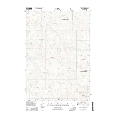
2014 Map of Phillips Butte
USGS Topo · Published 2014About this map
Custer National Forest lands dominate this portion of Powder River County, where the high-plains landscape is defined by a dense network of springs and man-made water catchments. The terrain is marked by prominent elevations such as Phillips Butte and Diamond Butte, which overlook the complex drainage systems of Elk Creek and North Fork Elk Creek. The land use here reflects a sophisticated approach to water management in an arid environment, evidenced by the numerous named reservoirs like Lyon Creek Divide Reservoir and Mud Turtle Reservoir. These features, alongside Coal Mine Spring and Rock Spring, provide a clear picture of the ranching and resource infrastructure that sustains this corner of Montana. Small-scale routes such as Sayle Road connect these points of interest, while draws like Coal Draw and Deadman Draw carve through the sections, offering a view of the local topography and naming conventions used by generations of land managers.
Find a feature on this map
53 named features on this map. Tap any name to fly to it.
Don’t see what you’re looking for? This feature index may not catch every label — zoom into the map to look around manually.
Map Details
Editions of this 2014 Phillips Butte Map
This is the sole edition of this map. No revisions or reprints were ever made.
Other maps of this area

1954 · Hardin
USGS Topo · 1:250,000

1954 · Ekalaka
USGS Topo · 1:250,000

1956 · Ekalaka
USGS Topo · 1:250,000

1957 · Hardin
USGS Topo · 1:250,000

1958 · Ekalaka
USGS Topo · 1:250,000

1958 · Hardin
USGS Topo · 1:250,000

1965 · Ekalaka
USGS Topo · 1:250,000

1966 · Goodspeed Butte
USGS Topo · 1:24,000

1966 · Sonnette
USGS Topo · 1:24,000

1966 · Phillips Butte
USGS Topo · 1:24,000