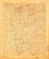
1894 Map of Pickens
USGS Topo · Published 1918About this map
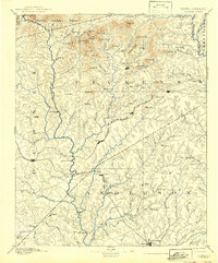
The Keowee River and Seneca River define the hydraulic character of this late 19th-century landscape, which was surveyed by C.M. Yeates in the mid-1880s. The region is marked by a transition from the mountainous heights of Rocky Bald Mt. and Cedar Rock Mt. in the north to the industrializing corridors of the Richmond and Danville Railroad in the south. This era captures the area before modern inundation, showing historic river crossings like Cherry Ferry, Shallow Ford, and Ravenee Bridge in their original contexts.
Find a feature on this map
118 named features on this map. Tap any name to fly to it.
Don’t see what you’re looking for? This feature index may not catch every label — zoom into the map to look around manually.
Map Details
Editions of this 1894 Pickens Map
6 editions found
Other maps of this area

1886 · Walhalla
USGS Topo · 1:125,000

1888 · Pickens
USGS Topo · 1:125,000

1891 · Cowee
USGS Topo · 1:125,000

1891 · Carnesville
USGS Topo · 1:125,000

1892 · Walhalla
USGS Topo · 1:125,000

1892 · Abbeville
USGS Topo · 1:125,000

1893 · Elberton
USGS Topo · 1:125,000

1894 · Pickens
USGS Topo · 1:125,000

1896 · Walhalla
USGS Topo · 1:125,000

1897 · Cowee
USGS Topo · 1:125,000