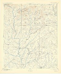
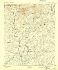
1894 Map of Pickens
USGS Topo · Published 1928About this map
The Keowee River and Little River systems dominate this landscape in the years before mid-twentieth-century dam projects altered the Piedmont waterways. The map highlights a critical period of transportation history, featuring the Richmond and Danville Railroad and the Atlanta and Charlotte Air Line, which fueled the growth of towns like Liberty and Central. Significant local-history detail is preserved in the locations of community landmarks such as New Hope Church and the original site of Old Pickens on the riverbank.
Find a feature on this map
122 named features on this map. Tap any name to fly to it.
Don’t see what you’re looking for? This feature index may not catch every label — zoom into the map to look around manually.
Map Details
Editions of this 1894 Pickens Map
6 editions found
Other maps of this area

1886 · Walhalla
USGS Topo · 1:125,000

1888 · Pickens
USGS Topo · 1:125,000

1891 · Cowee
USGS Topo · 1:125,000

1891 · Carnesville
USGS Topo · 1:125,000

1892 · Walhalla
USGS Topo · 1:125,000

1892 · Abbeville
USGS Topo · 1:125,000

1893 · Elberton
USGS Topo · 1:125,000

1894 · Pickens
USGS Topo · 1:125,000

1896 · Walhalla
USGS Topo · 1:125,000

1897 · Cowee
USGS Topo · 1:125,000