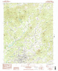
1983 Map of Pickens
USGS Topo · Published 1983About this map
Pickens serves as the focal point of this northern South Carolina landscape, where the town grid meets the rising foothills of the Blue Ridge. The geography is defined by a dense network of country churches and small schools that historically anchored these rural communities, including Oolenoy Ch and Porter Chapel. To the north, the terrain becomes increasingly complex as the Oolenoy River winds through the valley floor, overlooked by landmarks such as Walnut Cove Mtn and Chapman Mtn.
Find a feature on this map
43 named features on this map. Tap any name to fly to it.
Don’t see what you’re looking for? This feature index may not catch every label — zoom into the map to look around manually.
Map Details
Editions of this 1983 Pickens Map
2 editions found
Other maps of this area

1888 · Pickens
USGS Topo · 1:125,000

1894 · Pickens
USGS Topo · 1:125,000

1905 · Pisgah
USGS Topo · 1:125,000

1906 · Pisgah
USGS Topo · 1:125,000

1935 · Eastatoe Gap
USGS Topo · 1:24,000

1935 · Table Rock
USGS Topo · 1:24,000
1946 · Eastatoe Gap
USGS Topo · 1:24,000
1946 · Table Rock
USGS Topo · 1:24,000
1947 · Eastatoe Gap
USGS Topo · 1:24,000
1947 · Table Rock
USGS Topo · 1:24,000