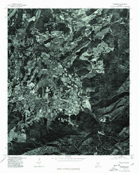
1975 Map of Piedmont
USGS Topo · Published 1977About this map
Piedmont, Alabama, is captured in this orthophotomap during the mid-1970s, revealing a landscape defined by the winding course of Terrapin Creek. This photographic survey provides a direct visual record of the region's physical layout, where agricultural fields and forested ridges intersect with the developed street grid of the Piedmont community. The imagery highlights the relationship between the built environment and the natural drainage patterns of the valley. Unlike traditional line maps, this orthophoto illustrates the actual land use and vegetation density of the era, offering researchers a literal view of the terrain as it existed when the aerial photography was captured in late 1975.
Find a feature on this map
1 named feature on this map. Tap any name to fly to it.
Don’t see what you’re looking for? This feature index may not catch every label — zoom into the map to look around manually.
Map Details
Editions of this 1975 Piedmont Map
This is the sole edition of this map. No revisions or reprints were ever made.
Other maps of this area

1886 · Rome
USGS Topo · 1:125,000

1889 · Tallapoosa
USGS Topo · 1:125,000

1892 · Tallapoosa
USGS Topo · 1:125,000

1893 · Fort Payne
USGS Topo · 1:125,000

1897 · Tallapoosa
USGS Topo · 1:125,000

1898 · Rome
USGS Topo · 1:125,000

1898 · Fort Payne
USGS Topo · 1:125,000

1899 · Rome
USGS Topo · 1:125,000

1900 · Fort Payne
USGS Topo · 1:125,000

1900 · Anniston
USGS Topo · 1:125,000