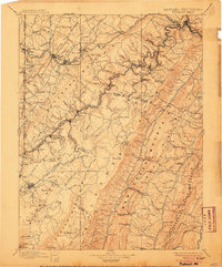
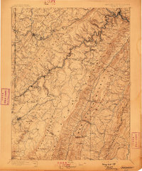
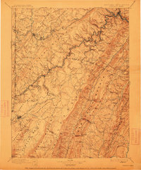
1895 Map of Piedmont
USGS Topo · Published 1906About this map
The Fairfax Stone marks a critical historical vertex on this survey of the Allegheny highlands, where the North Branch Potomac River carves through the landscape. This era is defined by the industrial expansion of the Baltimore and Ohio R.R. and the W.V.C. & P. R.R., which facilitated the movement of coal and timber from mountain settlements like Piedmont and Elk Garden. The terrain is characterized by massive ridges such as Backbone Mountain and New Creek Mountain, which forced early transport networks to follow gaps and river valleys.
Find a feature on this map
138 named features on this map. Tap any name to fly to it.
Don’t see what you’re looking for? This feature index may not catch every label — zoom into the map to look around manually.
Map Details
Editions of this 1895 Piedmont Map
4 editions found

Historical Maps of Petersburg Through Time
1 maps found