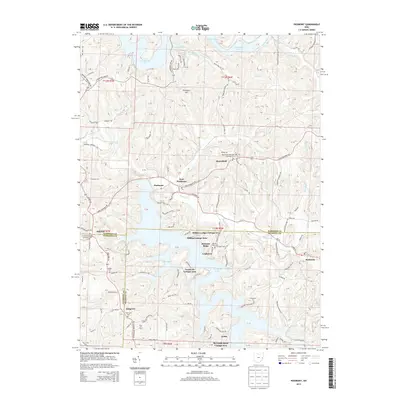
2013 Map of Piedmont
USGS Topo · Published 2013About this map
Piedmont Lake and Clendening Lake dominate the eastern Ohio landscape in this survey, where the borders of Harrison, Belmont, and Guernsey Counties meet. The region is characterized by established lakeside communities and recreation-focused developments such as the Hidden Ledges Cottage Area, Goodrich Cottage Area, and Reynolds Road Cottage Area. In the north, the settlement of Moorefield sits near the Moorefield Methodist Episcopal Cem, while the southern reaches include the town of Holloway and the B & O RR corridor. Local genealogy is well-documented through numerous burial grounds, including the Smyrna Methodist Episcopal Cem, Stillwater Cem, and the Quaker Cem near the Guernsey line. The transport network consists of local township roads and state routes that wind around the irregular shorelines of Essex Bay and Brushy Fork Bay, reflecting how these large impoundments reshaped the area's geography and connectivity.
Find a feature on this map
153 named features on this map. Tap any name to fly to it.
Don’t see what you’re looking for? This feature index may not catch every label — zoom into the map to look around manually.
Map Details
Editions of this 2013 Piedmont Map
This is the sole edition of this map. No revisions or reprints were ever made.
Other maps of this area

1902 · Scio
USGS Topo · 1:62,500

1903 · Flushing
USGS Topo · 1:62,500

1904 · Scio
USGS Topo · 1:62,500

1905 · Flushing
USGS Topo · 1:62,500

1909 · Antrim
USGS Topo · 1:48,000

1909 · Uhrichsville
USGS Topo · 1:62,500

1911 · Antrim
USGS Topo · 1:62,500

1911 · Uhrichsville
USGS Topo · 1:62,500

1951 · Canton
USGS Topo · 1:250,000

1953 · Canton
USGS Topo · 1:250,000