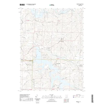
2019 Map of Piedmont
USGS Topo · Published 2019About this map
Piedmont Lake and Clendening Lake dominate this eastern Ohio landscape, where the irregular shorelines of Essex Bay and Huff Bay carve through the high ridges of Harrison, Guernsey, and Belmont Counties. The 2019 survey shows a region defined by its water-management infrastructure and small, enduring settlements. The village of Piedmont sits at the junction of Stillwater Creek and Boggs Fork, while the crossroads of Moorefield and the hilltop hamlet of Belmont Ridge occupy the higher ground between the reservoirs. Genealogists will find significant value in the distribution of religious and family burial grounds, including the Moorefield Methodist Episcopal Cem and the Quaker Cem. The North Country National Scenic Trail winds across the northern hills, following the contours of Prospect Hill and the drainage of Huff Run, illustrating the modern recreational use of this historically agricultural and hydraulic landscape.
Find a feature on this map
124 named features on this map. Tap any name to fly to it.
Don’t see what you’re looking for? This feature index may not catch every label — zoom into the map to look around manually.
Map Details
Editions of this 2019 Piedmont Map
This is the sole edition of this map. No revisions or reprints were ever made.
Other maps of this area

1902 · Scio
USGS Topo · 1:62,500

1903 · Flushing
USGS Topo · 1:62,500

1904 · Scio
USGS Topo · 1:62,500

1905 · Flushing
USGS Topo · 1:62,500

1909 · Antrim
USGS Topo · 1:48,000

1909 · Uhrichsville
USGS Topo · 1:62,500

1911 · Antrim
USGS Topo · 1:62,500

1911 · Uhrichsville
USGS Topo · 1:62,500

1951 · Canton
USGS Topo · 1:250,000

1953 · Canton
USGS Topo · 1:250,000