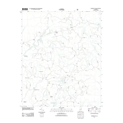
2011 Map of Piedmont SE
USGS Topo · Published 2011About this map
Liberty Hill and Grantley anchor the settlement pattern in this northeast Alabama landscape, where the southern reaches of the Appalachian foothills give way to a network of winding creeks and mountain ridges. The geography is defined by the prominent heights of Potter Mountain, Rattlesnake Mountain, and Wilkinson Mountain, which shadow the drainage basins of Choccolocco Creek and Shoal Creek. These watercourses are vital to the area's layout, supporting man-made features like Coleman Lake and its corresponding Coleman Dam.
Find a feature on this map
30 named features on this map. Tap any name to fly to it.
Don’t see what you’re looking for? This feature index may not catch every label — zoom into the map to look around manually.
Map Details
Editions of this 2011 Piedmont SE Map
This is the sole edition of this map. No revisions or reprints were ever made.
Other maps of this area

1889 · Tallapoosa
USGS Topo · 1:125,000

1892 · Tallapoosa
USGS Topo · 1:125,000

1897 · Tallapoosa
USGS Topo · 1:125,000

1900 · Anniston
USGS Topo · 1:125,000

1953 · Atlanta
USGS Topo · 1:250,000

1954 · Choccolocco
USGS Topo · 1:24,000

1957 · Atlanta
USGS Topo · 1:250,000

1958 · Atlanta
USGS Topo · 1:250,000
1966 · Borden Springs
USGS Topo · 1:24,000
1966 · Oak Level
USGS Topo · 1:24,000