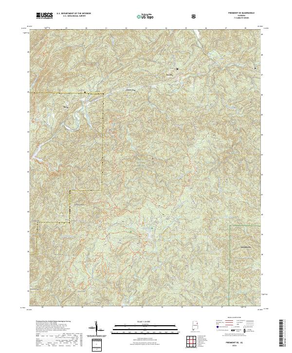
2024 Map of Piedmont SE
USGS Topo · Published 2024About this map
Edwardsville stands near the eastern boundary of this Cleburne County landscape, where the rugged elevations of the Talladega National Forest dominate the terrain. Significant high points like Dugger Mountain and Rattlesnake Mtn rise above the drainage basins of Choccolocco Creek and Shoal Creek. Small communities and named crossroads such as Grantley, Liberty Hill, and Burns are connected by a network of rural routes including Rabbittown RD and Co RD 55.
Find a feature on this map
45 named features on this map. Tap any name to fly to it.
Don’t see what you’re looking for? This feature index may not catch every label — zoom into the map to look around manually.
Map Details
Editions of this 2024 Piedmont SE Map
This is the sole edition of this map. No revisions or reprints were ever made.
Other maps of this area

1889 · Tallapoosa
USGS Topo · 1:125,000

1892 · Tallapoosa
USGS Topo · 1:125,000

1897 · Tallapoosa
USGS Topo · 1:125,000

1900 · Anniston
USGS Topo · 1:125,000

1953 · Atlanta
USGS Topo · 1:250,000

1954 · Choccolocco
USGS Topo · 1:24,000

1957 · Atlanta
USGS Topo · 1:250,000

1958 · Atlanta
USGS Topo · 1:250,000
1966 · Borden Springs
USGS Topo · 1:24,000
1966 · Oak Level
USGS Topo · 1:24,000