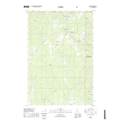
2020 Map of Pierce
USGS Topo · Published 2020About this map
Pierce stands as the central hub of this Clearwater County landscape, marking a historic area of Idaho where the discovery of gold first shaped the regional development. The map reveals a transition between active industry and the surrounding wilderness, specifically at Cardiff Mill and the nearby settlement of Judge Town. These nodes of activity are connected by rugged forest roads like Browns Creek Rd and French Mtn Rd, which navigate the steep terrain between Gold Hill and Pierce Divide. To the east, the boundary of the Clearwater National Forest encompasses landmarks such as Gold Dollar Flat and Saint Louis Gulch. This survey captures the complex drainage network of Orofino Cr and its numerous tributaries, reflecting an era where timber management and remnant mining claims defined the local economy.
Find a feature on this map
50 named features on this map. Tap any name to fly to it.
Don’t see what you’re looking for? This feature index may not catch every label — zoom into the map to look around manually.
Map Details
Editions of this 2020 Pierce Map
This is the sole edition of this map. No revisions or reprints were ever made.
Other maps of this area

1923 · Washington Creek
USGS Topo · 1:125,000

1924 · Weippe
USGS Topo · 1:125,000

1938 · Headquarters
USGS Topo · 1:48,000

1944 · Headquarters
USGS Topo · 1:62,500

1956 · Hamilton
USGS Topo · 1:250,000

1959 · Hamilton
USGS Topo · 1:250,000

1960 · Hamilton
USGS Topo · 1:250,000

1964 · Hamilton
USGS Topo · 1:250,000

1965 · French Mountain
USGS Topo · 1:24,000

1966 · Pierce
USGS Topo · 1:24,000