
1950 Map of Piercy
USGS Topo · Published 1952About this map
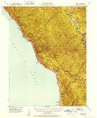
Andersonia and Piercy sit at the northeastern edge of this coastal survey, where the Redwood Highway follows the winding path of the South Fork Eel River. The landscape is dominated by the steep rises of Jackass Ridge and Timber Ridge, reflecting a period when small settlements like Wheeler and Usal served as remote outposts along the Pacific. The inclusion of Moody (Site) and Kenny (Site) indicates formerly active locations that had already transitioned to historical sites by the mid-century field check. Along the shoreline, nautical landmarks such as Needle Rock, Bear Harbor, and Mistake Point highlight the challenges of navigating this stretch of the coast. Inland, the map documents a network of family-named locations and ranches, including Reynolds and the DeVilbiss Ranch, set among the numerous gulches and creeks feeding the larger river systems.
Find a feature on this map
49 named features on this map. Tap any name to fly to it.
Don’t see what you’re looking for? This feature index may not catch every label — zoom into the map to look around manually.
Map Details
Editions of this 1950 Piercy Map
5 editions found
Other maps of this area

1920 · Pt. Delagda
USGS Topo · 1:62,500

1920 · Cummings
USGS Topo · 1:62,500

1920 · Harris
USGS Topo · 1:62,500

1921 · Westport
USGS Topo · 1:62,500

1921 · Briceland
USGS Topo · 1:62,500

1921 · Branscomb
USGS Topo · 1:62,500

1949 · Eureka
USGS Topo · 1:250,000

1949 · Alderpoint
USGS Topo · 1:62,500

1949 · Point Delgada
USGS Topo · 1:62,500

1949 · Garberville
USGS Topo · 1:62,500