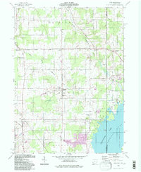
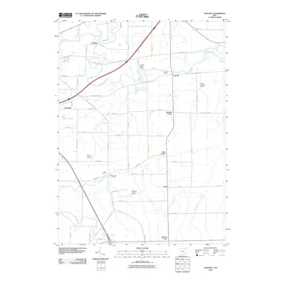
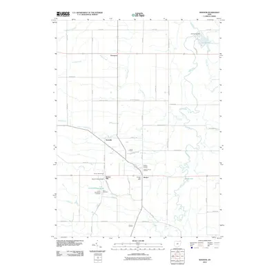
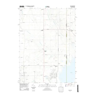
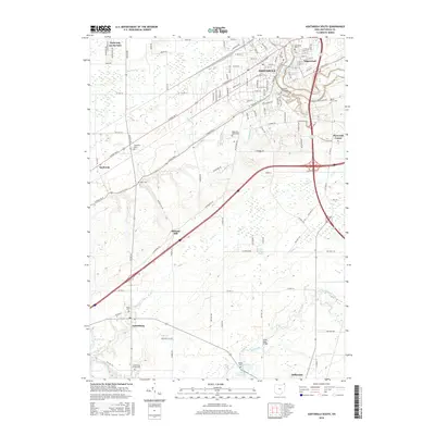
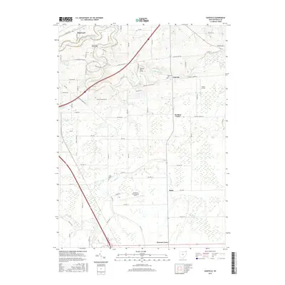
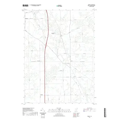
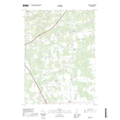
1960 Map of Pierpont
USGS Topo · Published 1970About this map
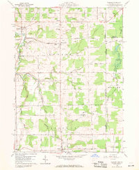
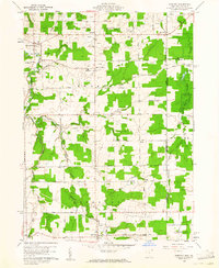
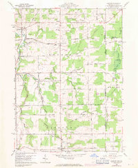
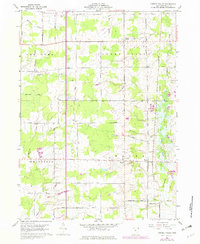
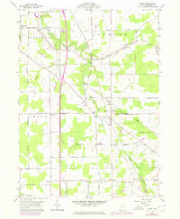
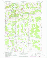
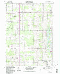
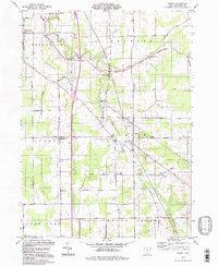
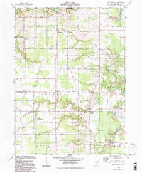
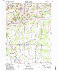
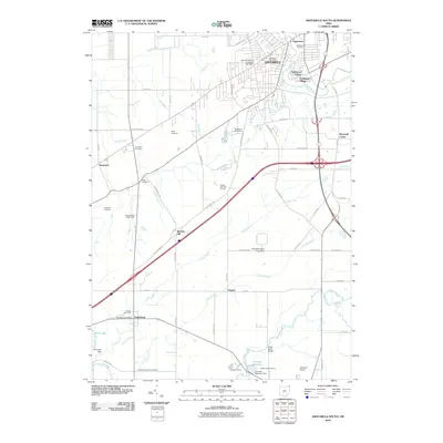
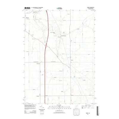
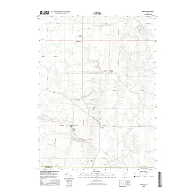
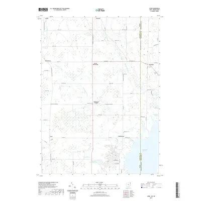
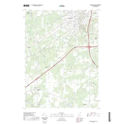
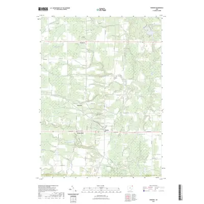
Ashtabula River and its multiple branches carve through this portion of the Connecticut Western Reserve during the early 1960s. The landscape reflects a rural economy deeply integrated with natural resource extraction, evidenced by the numerous Gas Wells and Oil Wells peppered across the townships of Monroe and Pierpont. Small crossroads settlements like Monroe Center and Bushnell serve as local anchors, while the larger village of Pierpont sits near the southern boundary. To the east, the state line between Ohio and Pennsylvania is marked by the sprawling State Game Lands No 101, which straddles the border near Wing. Genealogists will find significant detail in the placement of family-centric landmarks such as Monroe Cem, Reeds Corners Cem, and the Monroe Sch, providing a clear view of the community structure before modern consolidation changed these township landscapes.
Find a feature on this map
52 named features on this map. Tap any name to fly to it.
Don’t see what you’re looking for? This feature index may not catch every label — zoom into the map to look around manually.
Map Details
Editions of this 1960 Pierpont Map
4 editions found
Historical Maps of Pierpont Through Time
66 maps found
1959 Cherry Valley
Ashtabula County, OH
1959 Dorset
Ashtabula County, OH
1959 East Trumbull
Ashtabula County, OH
1959 Leon
Ashtabula County, OH
1959 Windsor
Ashtabula County, OH
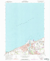
1960 Ashtabula North
Ashtabula County, OH
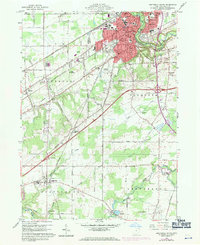
1960 Ashtabula South
Ashtabula County, OH
1960 Gageville
Ashtabula County, OH
1960 Pierpont
Ashtabula County, OH
1994 Cherry Valley
Ashtabula County, OH
1994 Dorset
Ashtabula County, OH
1994 East Trumbull
Ashtabula County, OH
1994 Gageville
Ashtabula County, OH
1994 Leon
Ashtabula County, OH
1994 Pierpont
Ashtabula County, OH
1994 Windsor
Ashtabula County, OH
2010 Ashtabula North
Ashtabula County, OH
2010 Ashtabula South
Ashtabula County, OH
2010 Cherry Valley
Ashtabula County, OH
2010 Dorset
Ashtabula County, OH
2010 East Trumbull
Ashtabula County, OH
2010 Gageville
Ashtabula County, OH
2010 Geneva OE N
Ashtabula County, OH
2010 Leon
Ashtabula County, OH
2010 Pierpont
Ashtabula County, OH
2010 Windsor
Ashtabula County, OH
2013 Ashtabula North
Ashtabula County, OH
2013 Ashtabula South
Ashtabula County, OH
2013 Cherry Valley
Ashtabula County, OH
2013 Dorset
Ashtabula County, OH
2013 East Trumbull
Ashtabula County, OH
2013 Gageville
Ashtabula County, OH
2013 Geneva OE N
Ashtabula County, OH
2013 Leon
Ashtabula County, OH
2013 Pierpont
Ashtabula County, OH
2013 Windsor
Ashtabula County, OH
2016 Ashtabula North
Ashtabula County, OH
2016 Ashtabula South
Ashtabula County, OH
2016 Cherry Valley
Ashtabula County, OH
2016 Dorset
Ashtabula County, OH
2016 East Trumbull
Ashtabula County, OH
2016 Gageville
Ashtabula County, OH
2016 Geneva OE N
Ashtabula County, OH
2016 Leon
Ashtabula County, OH
2016 Pierpont
Ashtabula County, OH
2016 Windsor
Ashtabula County, OH
2019 Ashtabula North
Ashtabula County, OH
2019 Ashtabula South
Ashtabula County, OH
2019 Cherry Valley
Ashtabula County, OH
2019 Dorset
Ashtabula County, OH
2019 East Trumbull
Ashtabula County, OH
2019 Gageville
Ashtabula County, OH
2019 Geneva OE N
Ashtabula County, OH
2019 Leon
Ashtabula County, OH
2019 Pierpont
Ashtabula County, OH
2019 Windsor
Ashtabula County, OH
2023 Ashtabula North
Ashtabula County, OH
2023 Ashtabula South
Ashtabula County, OH
2023 Cherry Valley
Ashtabula County, OH
2023 Dorset
Ashtabula County, OH
2023 East Trumbull
Ashtabula County, OH
2023 Gageville
Ashtabula County, OH
2023 Geneva OE N
Ashtabula County, OH
2023 Leon
Ashtabula County, OH
2023 Pierpont
Ashtabula County, OH
2023 Windsor
Ashtabula County, OH
Featured Locations
- Pierpont Township, OH
- Kingsville Township, OH
- Pierpont, Pierpont Township
- Kelloggsville, Monroe Township
- Monroe Center, Monroe Township