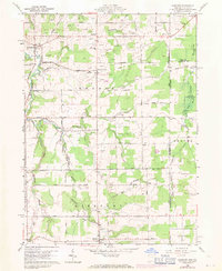
1960 Map of Pierpont
USGS Topo · Published 1971About this map
The Ashtabula River and its multiple branches define the agricultural and wooded landscape of this borderland area during the mid-20th century. The settlement of Pierpont serves as a local hub near the southern edge, while the hamlets of Kelloggsville, Bushnell, and Monroe Center are connected by a network of rural routes like Kelloggsville Road and Gageville Monroe Road. The presence of numerous Gas Wells and several Oil Wells scattered across the township suggests an era of active local resource extraction alongside traditional farming.
Find a feature on this map
53 named features on this map. Tap any name to fly to it.
Don’t see what you’re looking for? This feature index may not catch every label — zoom into the map to look around manually.
Map Details
Editions of this 1960 Pierpont Map
4 editions found
Other maps of this area

1900 · Girard
USGS Topo · 1:62,500

1905 · Andover
USGS Topo · 1:48,000

1906 · Conneaut
USGS Topo · 1:62,500

1906 · Linesville
USGS Topo · 1:62,500

1907 · Andover
USGS Topo · 1:62,500

1908 · Linesville
USGS Topo · 1:62,500

1950 · Cleveland
USGS Topo · 1:250,000

1956 · Cleveland
USGS Topo · 1:250,000

1959 · East Springfield
USGS Topo · 1:24,000

1959 · Beaver Center
USGS Topo · 1:24,000