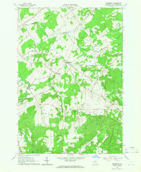
1964 Map of Pierrepont
USGS Topo · Published 1976About this map
Pierrepont and its surrounding rural hamlets are documented here during a period of established agricultural and forest life in St. Lawrence County. The landscape is defined by the winding course of the Little River and numerous tributaries like Trout Brook and Boyden Brook, which carved the terrain long before modern development. Notable centers of community life are preserved in the positioning of the Beach Plains Ch, White Church, and the Giffins Corners Sch.
Find a feature on this map
59 named features on this map. Tap any name to fly to it.
Don’t see what you’re looking for? This feature index may not catch every label — zoom into the map to look around manually.
Map Details
Editions of this 1964 Pierrepont Map
Other maps of this area

1908 · Potsdam
USGS Topo · 1:62,500

1910 · Canton
USGS Topo · 1:62,500

1911 · Canton
USGS Topo · 1:62,500

1915 · Russell
USGS Topo · 1:62,500

1918 · Russell
USGS Topo · 1:62,500

1921 · Stark
USGS Topo · 1:62,500

1923 · Stark
USGS Topo · 1:62,500

1940 · Stark
USGS Topo · 1:62,500

1943 · Potsdam
USGS Topo · 1:31,680
1943 · Colton
USGS Topo · 1:31,680