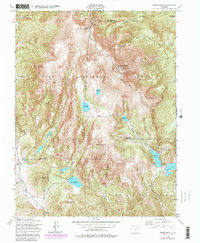
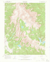
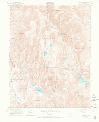
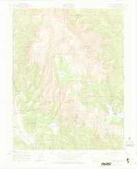
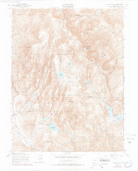
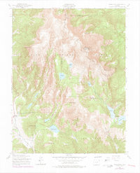
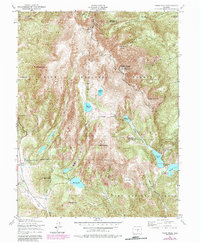
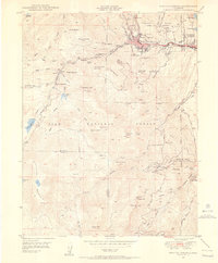
1951 Map of Pikes Peak
USGS Topo · Published 1987About this map
Pikes Peak Cog Railway dominates the high-altitude landscape of Teller County, winding its way toward the Summit House at the peak's crest. This 1951 survey, with 1980s updates, reveals a complex network of water management essential to the region, including the Strickler Tunnel and a series of numbered reservoirs such as Reservoir No 8 and Reservoir No 2. Near the western edge, the settlement of Gillett sits in the valley above the West Fork Beaver Creek, providing a glimpse into the high-country communities established in the shadow of the mountains.
Find a feature on this map
46 named features on this map. Tap any name to fly to it.
Don’t see what you’re looking for? This feature index may not catch every label — zoom into the map to look around manually.
Map Details
Editions of this 1951 Pikes Peak Map
9 editions found


Other maps of this area

1893 · Colorado Springs
USGS Topo · 1:125,000

1894 · Pikes Peak
USGS Topo · 1:125,000

1901 · Pikes Peak
USGS Topo · 1:125,000

1901 · Pikes Peak
USGS Topo · 1:62,500

1909 · Colorado Springs
USGS Topo · 1:125,000

1942 · Colorado Springs
USGS Topo · 1:125,000
1948 · Mount Big Chief
USGS Topo · 1:24,000
1948 · Manitou Springs
USGS Topo · 1:24,000

1948 · Colorado Springs
USGS Topo · 1:62,500
1948 · Cascade
USGS Topo · 1:24,000