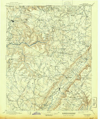
1895 Map of Pikeville
USGS Topo · Published 1943About this map
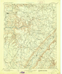
Sparta and Crossville serve as primary hubs in this late 19th-century survey of the Cumberland Plateau, where the landscape is defined by the steep descent of the Caney Fork and the emergence of industrial coal mining. The presence of the Rock House and Eastland Stand highlights the area's legacy of early thoroughfares and taverns, while the Nashville Chattanooga and St Louis R R snakes through the high country to reach the mines at Bon Air. Settlement patterns follow the complex geography of gaps and coves, with small communities like Pleasant Hill and Lantana established along the ridge lines. Along the river, Hodge Ferry provides a vital crossing point, and scattered landmarks such as Hale Chapel and Taylor Mill anchor the rural social and economic life of the plateau's residents during this era of rail-driven expansion.
Find a feature on this map
146 named features on this map. Tap any name to fly to it.
Don’t see what you’re looking for? This feature index may not catch every label — zoom into the map to look around manually.
Map Details
Editions of this 1895 Pikeville Map
7 editions found

Other maps of this area

1886 · Cleveland
USGS Topo · 1:125,000

1887 · Kingston
USGS Topo · 1:125,000

1888 · Chattanooga
USGS Topo · 1:125,000

1891 · Kingston
USGS Topo · 1:125,000

1892 · Pikeville
USGS Topo · 1:125,000

1892 · Cleveland
USGS Topo · 1:125,000

1893 · Mc Minnville
USGS Topo · 1:125,000

1893 · Chattanooga
USGS Topo · 1:125,000

1893 · Kingston
USGS Topo · 1:125,000

1895 · Cleveland
USGS Topo · 1:125,000