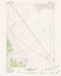
1971 Map of Pilot
USGS Topo · Published 1983About this map
Morris Basin and the expansive Pilot Creek Valley define this portion of Elko County, where the high desert landscape meets a critical transportation corridor. The map highlights the prominent Western Pacific railroad line and a parallel Aqueduct, which cut a straight diagonal path across the alluvial fans. This infrastructure signifies the importance of managing water and transit through the arid Great Basin, where natural resources like Pilot Well and Playa Res are rare and essential features.
Find a feature on this map
18 named features on this map. Tap any name to fly to it.
Don’t see what you’re looking for? This feature index may not catch every label — zoom into the map to look around manually.
Map Details
Editions of this 1971 Pilot Map
2 editions found
Other maps of this area

1955 · Elko
USGS Topo · 1:250,000

1958 · Elko
USGS Topo · 1:250,000

1962 · Elko
USGS Topo · 1:250,000

1965 · Elko
USGS Topo · 1:250,000

1971 · West Morris Basin
USGS Topo · 1:24,000
1971 · Silver Zone Pass
USGS Topo · 1:24,000
1971 · Miners Canyon
USGS Topo · 1:24,000

1971 · Pilot
USGS Topo · 1:24,000

1971 · Leppy Peak
USGS Topo · 1:24,000
1971 · Leppy Peak NW
USGS Topo · 1:24,000